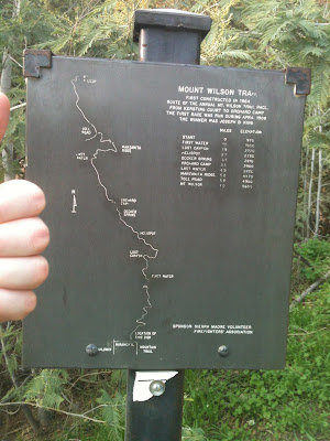
Ever since I moved to Southern California I have wanted to climb Mount Wilson. Edwin Hubble discovered the expansion of the universe in 1929 using the observatory on Mount Wilson. From the trail head in Sierra Madre it is a seven mile hike with a net vertical climb of about one mile. I have started up the trail twice before with my kids, but only made it as far as First Water, 1.5 miles from the start. The first time, we had to turn around before First Water because my then 12-year-old daughter did not wear socks. The second time, I went with my two youngest sons who were 18 and 16 at the time. I wanted to get at least as far as Orchard Camp, 2 miles beyond First Water, but my 18 year old prevailed in encouraging us to turn around after we reached First Water.
On Saturday January 5, 2013 my youngest son (now 18) and I made our third attempt. This was actually our first serious attempt. We never intended to push all the way to the summit the two previous times. We only wanted to familiarize ourselves with the trail and go on a short hike. We had no idea what to expect beyond First Water, except for the information we could glean from reading the blogs of other hikers that my wife found for us. Our research seemed to indicate that many hikers only hiked up and then got a ride at the top. We planned to hike up and back down for a total of 14 miles. At least two blog authors actually hiked 18 miles because they could not find the continuation of the trail after the toll road and were not convinced that a 7-mile route to the top existed. It was good that we read these blogs so that we could be alert to find the trail off the toll road and ask questions of other hikers. It is an easy mistake to make.
The weather was clear the day of our hike. The temperatures were mild for this time of year. The high on Mount Wilson was expected to be 50 degrees while the high at the trail head in Sierra Madre was in the 60s. We started at 7 a.m. when the temperature was about 38 degrees. The cool temperatures allowed us to carry less water than a summer hike would have required. We carried 2 liters each. For food, we each packed two peanut butter sandwiches, two snickers bars, and trail mix. This all turned out to be adequate, although by the end of the hike I wished that I had brought another liter of water. On the other hand, my son only drank about 1.5 liters.
I will share just a bit of information about us so that our perception of the difficulty of this hike can be put into perspective. I am 49 years old and need to lose at least 30 pounds, but I am quite active. I exercise about an hour daily with a routine that includes resistance training and running anywhere from 3-7 miles. I have run as far as 12 miles, but not recently. My son was on his high school cross country team, but he has just recently recovered from a stress fracture. He has been able to get back to running only about a month before our hike. I ran two 5K races this year and my best time was 28:30. My son's best 5K time is around 22 minutes.
Since our starting time was roughly at sunrise, I figured that we needed to turn around by noon to make it back before dark. I was willing to stretch it to 1 p.m. if necessary since I thought the descent might be a little faster than the ascent. Having no idea what to expect or how my body would respond to this hike, I did not put our chances of success very high. My son, on the other hand, was much more optimistic. I think we both understood that success depended on whether I could do it since he is much younger, in better shape, and not overweight like me.
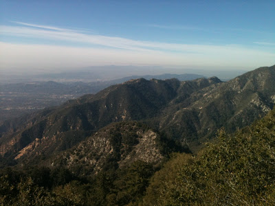
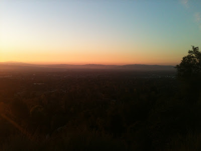 |
| Sunrise over the San Gabriel Valley from the Mount Wilson Trail |
The first quarter mile of the hike left me winded and with my calves threatening to cramp up. At that point, I did not see how I could possibly keep this up for 14 miles. However, the farther we went the more I began to settle into a pace that seemed a little more maintainable. Occasional relief from the relentlessly steep grade provided a welcome opportunity for recovery. I found that even brief periods of rest were extremely beneficial.
We arrived at First Water, 1.5 miles from the trail head, after about 40 minutes. At that point I finally felt like I could make it. We were averaging better than two miles per hour and it now seemed manageable. My son was having no trouble at all. He would get ahead of me and then stop and wait for me to catch up. Our next milestone was making it to Orchard Camp, the halfway point 2 miles beyond first water. This leg felt easier than the first. The trail flattened out and even occasionally descended providing rest periods without the necessity of stopping.
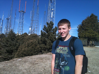
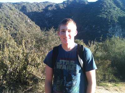 |
| My son at about the halfway point |
If we divide the ascent roughly into quarters, the third leg is the most difficult. Between Orchard Camp and Manzanita Ridge is a distance of 1.7 miles, but the grade is relentlessly steep and often over rocks. In one spot the trail entirely disappears and hikers must negotiate a tricky corner on hands and feet. For me, it also required a short jump after which I nearly lost my balance. If I had not caught myself I might have fallen about six feet onto a steep, rocky, slope below. It probably would not have been catastrophic, but could have easily resulted in injury.
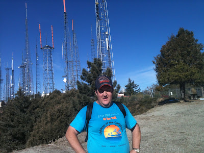
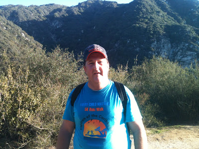 |
| Me at the same spot |
We spoke with an experienced hiker at Manzanita Ridge who had made this climb many times. He passed us while we were resting and having a snack just before, and he was still at Manzanita Ridge when we arrived. We had not realized how close we were or we would have pressed on. He assured us that we had just made it through the most difficult part of the trail. From here to the top, another 1.8 miles, was much easier than what we had just been through. I made sure to ask him about finding where the trail continues from the toll road so we did not do the 18 mile version of the hike I found in other blogs. I do not remember the details he told us, but we were able to find it by watching for it.
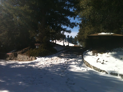
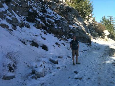 |
| Part of the toll road covered with snow |
The toll road begins just a half mile beyond Manzanita Ridge. We started looking for the trail continuation immediately once we were on the toll road. After we did not see it right away, we thought we might have gone the wrong way. We went back a ways, double checked the signs, and asked other hikers before we were convinced that we were going the right way. It took quite a while before my son finally spotted it. I do not know the exact distance that we hiked on the toll road, but I believe it was around three quarters of a mile. The toll road comes to a T intersection. It is tempting to turn right and continue on the road, but I believe that this is the mistake the other hikers made. Just before the T intersection on the right side of the toll road is the trail continuation. This final leg of the trail is steep, but short. My son hiked ahead. A short time later he called out and I could see him above me, assuring me that he had reached the top. I continued up to where he was and found myself in the parking lot where I had parked two summer ago when my kids and I drove to the top.
 |
| The view from near the top |
 |
| So close to the top that we can see the TV towers |
 |
| We finally made it |
 |
| Proof that I made it too |
From the parking lot, there is still a little more of a climb along a paved trail to reach the actual summit. At the very top, there is a pavilion with picnic tables and the Cosmic Cafe in the center. The cafe is only open April through November so we had to eat the food we brought. The restrooms are also closed so we had to resort to nature for those needs. These inconveniences and the cool weather were well worth it to avoid the large insects that are active in the summer, as we learned when we drove up two summers ago. Summer hikers are advised to bring ample insect repellant.
 |
| The trail up to the pavilion |
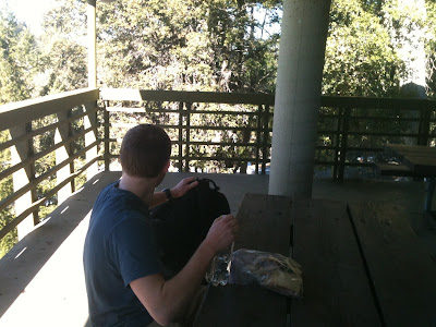 |
| Lunch at the pavilion |
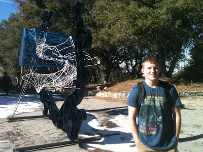 |
| A modern sculpture at the summit |
 |
| The trail head from Mount Wilson for the descent |
We arrived at the top around 11:30 a.m. and stayed for about half an hour. The descent took less time. We arrived back at our car in Sierra Madre by 3 p.m. At first the descent was a welcome relief to all that climbing. I never got winded as on the ascent, but it did not take that long for an entirely different set of muscles to become fatigued. Going up it was my calves that got most tired, but it was my thighs on the way down. When we had barely made it as far and Manzanita Ridge I had trouble re-tying my shoes after emptying the gravel out. The problem was that when I brought my leg up to tie my shoe my thigh would immediately begin to cramp up. I had to have my son help me tie one of them. If I did not run regularly I think this hike would have been impossible for me. As it was, it was still very challenging. It was like doing four hours worth of calf raises on the way up, and then another three hours worth of leg extensions on the way down. My legs were just not quite accustomed to this level of activity. Running on a flat surface does not quite cut it. On the way down I found myself longing for something flat to walk on. Even the short segments where the trail goes up were a relief because they used different muscles than the constant descending.
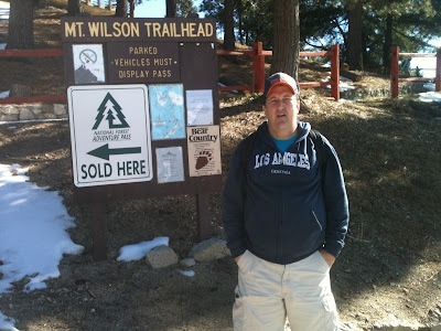
 |
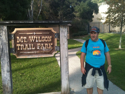
| The sign back at the Sierra Madre trail head |
 |
| Back in Sierra Madre |
It took about five days for my legs to recover from this hike. This was much more than normal workout soreness. The first few days I found it easier to go down the stairs in our home backwards. In spite of the pain, the sense of accomplishment was exhilarating. I want to do it again.


